Geothermal · Water, heat and minerals
Understand Heat at the Surface
Geothermal areas are where groundwater meets volcanic heat and comes back up changed: boiling, acidic, mineral-laden and sometimes explosive. They are among the most visited and most underestimated volcanic environments.
Field note · The plumbing
How a geothermal field works
Rain and snowmelt seep down through fractured volcanic rock until they reach rock heated by magma at depth. Pressure lets that water exceed 100 °C without boiling. As it rises, pressure drops, and what reaches the surface depends on how much water is available and how the channels are shaped.
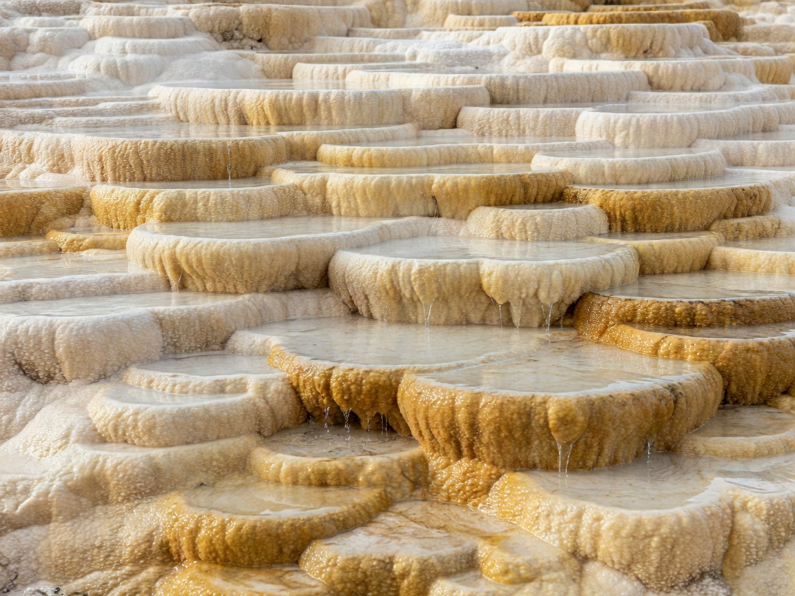
Plenty of water and open channels produce hot springs. Plenty of water and a narrow constriction produce geysers, which erupt when trapped water flashes to steam. Little water and abundant gas produce fumaroles, and where acidic gas rots the rock into clay, mud pots form. The dissolved minerals then precipitate as silica sinter, travertine or sulfur crystals, building the terraces and crusts that photographers love.
Those same processes make the ground itself unreliable. Acidic fluids dissolve rock from below, leaving thin crusts over boiling water. Features can change temperature, migrate or erupt where none existed. Yellowstone's park service warns that hot springs have injured and killed more visitors there than any other natural feature.
Safety notice · Thermal areas
- Boardwalks only
Never step off marked paths, even for a photo. Crust can be centimetres thick.
- Never touch the water
Many springs are near boiling and strongly acidic.
- Gas in hollows
Carbon dioxide and hydrogen sulfide can pool in low ground and enclosed spaces.
- Bathe only where designated
Use official pools such as managed hot-spring facilities.
Features and where to see them
Water-dominated
- Yellowstone and Haukadalur
Yellowstone hosts roughly half of the world's active geysers; Old Faithful's eruptions are forecast by rangers. In Iceland, Strokkur erupts every few minutes beside the largely dormant Geysir that gave all geysers their name.
- El Tatio, Chile
A geyser field at around 4,300 m in the Andes, best seen at dawn when cold air makes steam columns visible. Altitude and freezing temperatures are part of the hazard.
- Grand Prismatic Spring
Concentric colour bands are microbial mats, each tuned to a temperature range, with the hottest centre too hot for most life.
Gas-dominated
- Seltún, Krýsuvík, Iceland
Steam vents and boiling mud on altered, colourful hillsides, crossed by boardwalks.
- Rotorua and Waimangu, New Zealand
Waimangu Volcanic Valley formed after the 1886 Tarawera eruption, making it one of the youngest geothermal ecosystems on Earth.
- Bumpass Hell, Lassen Volcanic NP
An acid-sulfate area of boiling pools and fumaroles reached by trail and boardwalk, open seasonally.
- Beppu, Japan
The "hells" of Beppu showcase coloured springs and steam vents within a hot-spring town.
Rock-feature annotations
Reading mineral colour
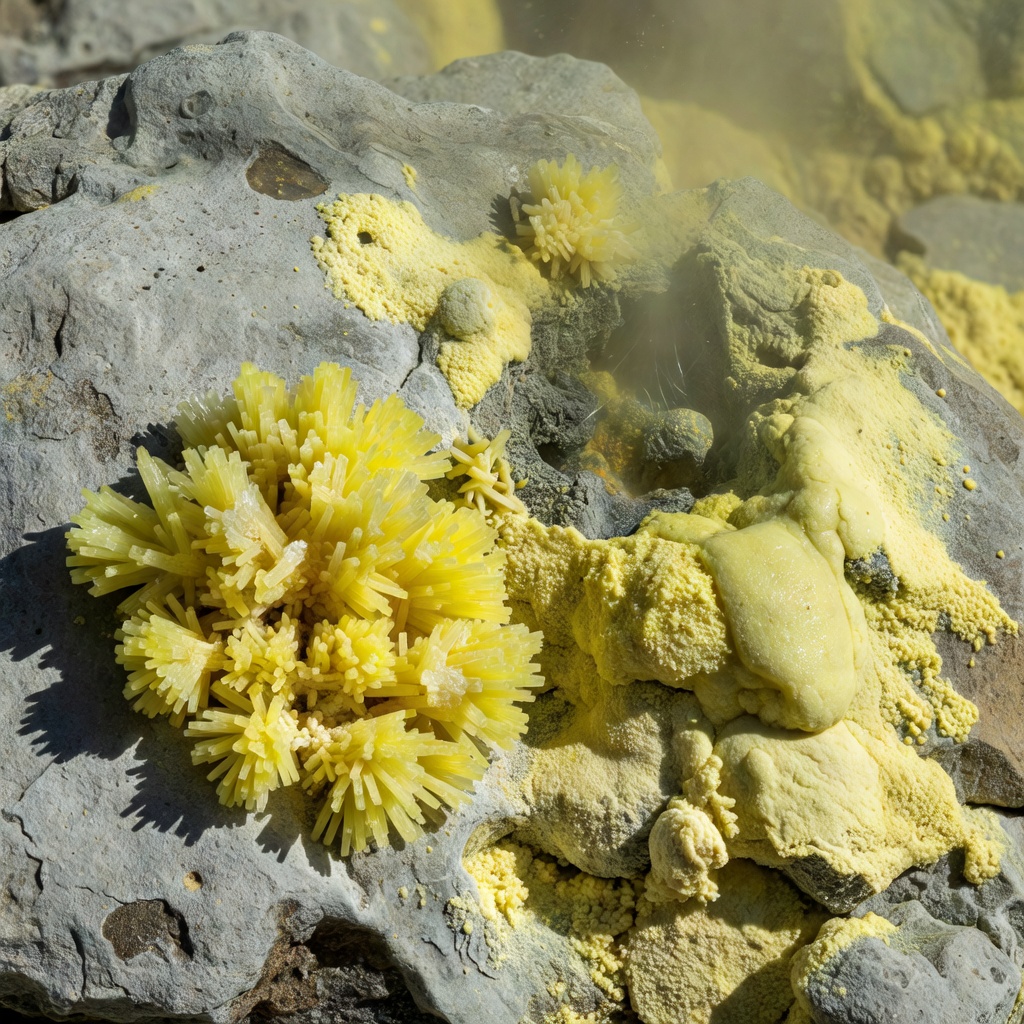
- Yellow
- Elemental sulfur deposited from gas at fumaroles.
- White
- Silica sinter (geyserite) or clay from acid-leached rock.
- Cream–ochre
- Travertine (calcium carbonate) or iron-stained sinter.
- Red–orange
- Iron oxides, or heat-tolerant microbial mats in outflow channels.
- Grey mud
- Rock decomposed into clay by acidic steam.
Colour tells you chemistry, not temperature or safety. A pale, dry-looking patch can be as dangerous as a boiling pool.
Historical timeline · Lessons from hot ground
Why the rules are strict
- 1886Tarawera erupts, destroying the Pink and White Terraces near Rotorua, then the region's best-known sinter formations.
- 2014Mount Ontake, Japan: a steam-driven (phreatic) eruption with little warning kills dozens of hikers near the summit.
- 2017A family dies after ground collapse at the Solfatara crater, Pozzuoli; the site remains closed.
- 2019Whakaari / White Island erupts while visitors are in the crater; 22 people die.
Steam-driven eruptions are hard to forecast. That is why authorities close geothermal craters at modest signs of unrest. Confirm current status with GeoNet, the USGS or the local equivalent before every visit.